Eastern Turkiye Part 2: Lake Van to Gaziantep (See Map)
Around Lake Van
Lake Van is the largest lake in Turkiye. The city of Van on its eastern shore
has been a major urban area since 1st century BCE.
The area has many tourists, locally and from Iran which is less than 50 miles to the east.
While we were having lunch at a lakeside resturant, we heard loud music and women dancing in a tour bus.
Our tour guide told us they were Iranians. They were dancing with joy as dancing is not allowed in Iran.
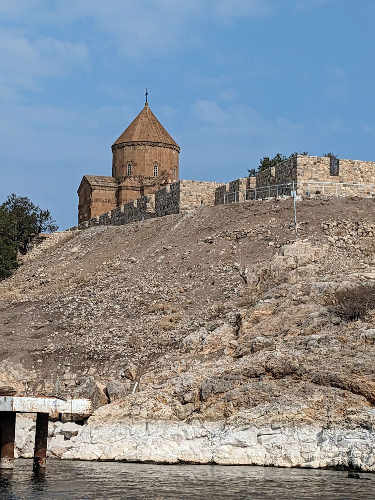
 Akdamar Island in Lake Van: (L) Cathedral of the Holy Cross (R) Medieval Armenian church with
biblical scene carvings
Akdamar Island in Lake Van: (L) Cathedral of the Holy Cross (R) Medieval Armenian church with
biblical scene carvings

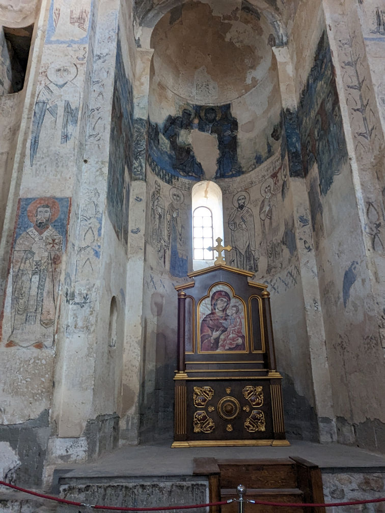 Medieval Armenian church: (L) Exterior (R) Interior

 (L) Castle ruins in Hosap village (R) Unusual rock formation near Castle that looks like a city wall

 Nemrut Caldera, a volcanic caldera atop Volcano Nemrut just west of Lake Van.
This is different from Mount Nemrut which we visited later. Crator Lake Nemrut is in the background.
The caldera is a national monumment and protected weland in Turkiye.
Nemrut Caldera, a volcanic caldera atop Volcano Nemrut just west of Lake Van.
This is different from Mount Nemrut which we visited later. Crator Lake Nemrut is in the background.
The caldera is a national monumment and protected weland in Turkiye.

 (L) Ahlat Seljuk Tombs located just north of Lake Van is an open-air museum with the
world's largest Turkish-Islamic cemetery in the Middle Ages
(L) Ahlat Seljuk Tombs located just north of Lake Van is an open-air museum with the
world's largest Turkish-Islamic cemetery in the Middle Ages
Around Mardin

 (L) Malabadi Bridge near Batman, a 12th-century stone arch bridge spanning the Batman River
(R) Eastern Turkiye has a well-maintained network of highways, with many long tunnels through the mountains.

 (L) The new Hasankeyf is a town located along the Tigris. The old town was flooded as part of the Ilisu Dam project
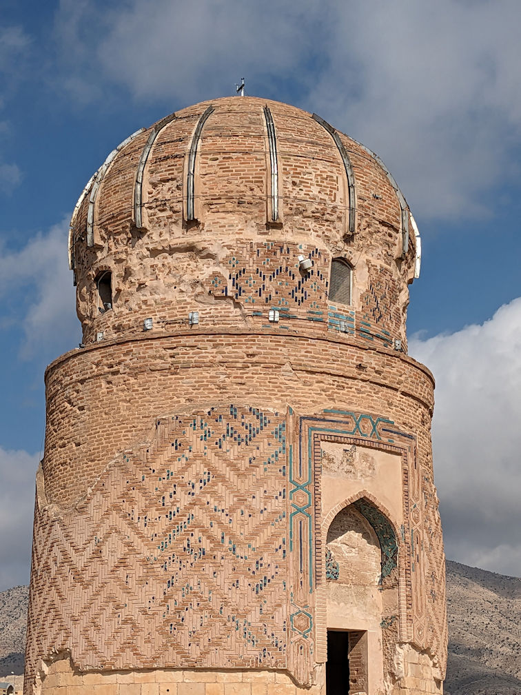
(R) Zeynel Bey Tomb in Hasankeyf relocated from the old town
(L) The new Hasankeyf is a town located along the Tigris. The old town was flooded as part of the Ilisu Dam project
(R) Zeynel Bey Tomb in Hasankeyf relocated from the old town

 (L) Midyat, a town near Mardin, is 20 miles from the Syrian border
(R) A Christian church tower in Midyat
(L) Midyat, a town near Mardin, is 20 miles from the Syrian border
(R) A Christian church tower in Midyat

 (L) Midyat mansion with many tourists
(R) Local women all decked out with colorful jewelery-hanging headscarves
(L) Midyat mansion with many tourists
(R) Local women all decked out with colorful jewelery-hanging headscarves
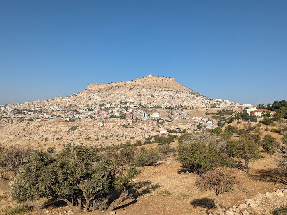
 (L) Mardin, 10 miles north of the Syrian border, is the home town of our Turkish guide Hassan who is Kurdish
(R) Hassan took us and Victor (a fellow traveller in the same tour) to a Kurdish coffee house/bookstore for some home-brewed wine.
The bookstore appears to be a famous local spots as we saw several people came in to post for photos.

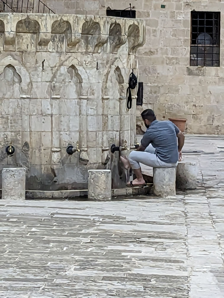 (L) Minuret lit up at night in Mardin
(R) Person washed feet before going into mosque for evening prayer

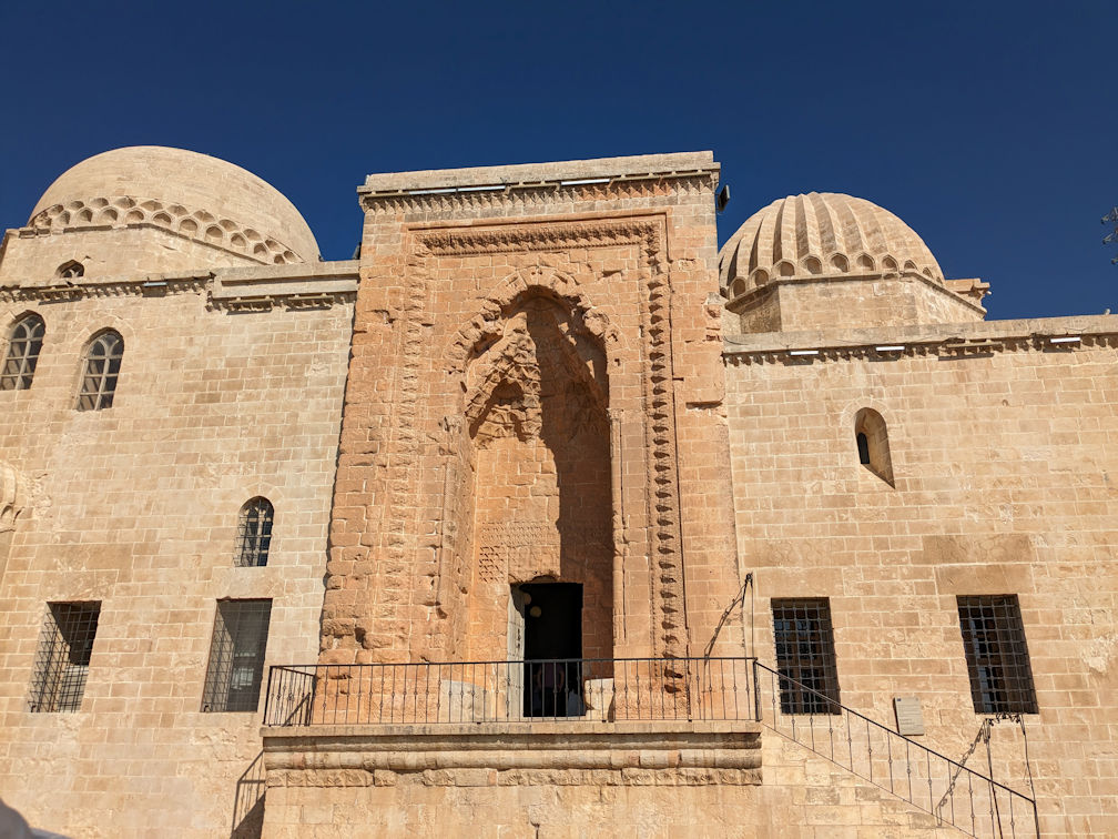 (L) Parties with loud music throughout the night in Mardin (R) Kasimiye Madrasa in Mardin

 (L) Wedding inside Kasimiye Madrasa
(R) Photo of our tour group in Kasimiye Madrasa
(L) Wedding inside Kasimiye Madrasa
(R) Photo of our tour group in Kasimiye Madrasa

 (L) Ongozlu Bridge, 11th century bridge with 10 arches, in Diyarbakir
(R) Restaurants were set up by the river side. There were lots of visitors. Some of them danced on the bridge
(video)
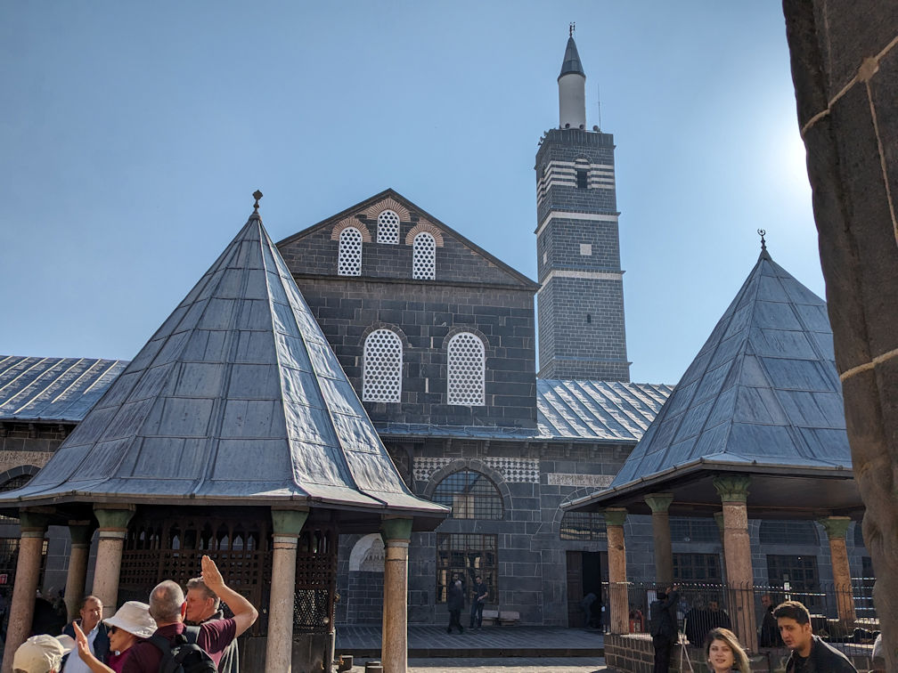
 Diyarbakir Grand Mosque: (L) Exterior (R) Interior

 (L) Sheikh Mutahhar Mosque in Diyarbakir is famous for its four-legged minaret.
Built in four corners on a monolithic stone column, it is the only example of a four-legged minaret in Turkiye.
The four legs symbolize the four sects of Islam.
According to a belief, the wishes of those who pass under the columns seven times are granted.
(L) Sheikh Mutahhar Mosque in Diyarbakir is famous for its four-legged minaret.
Built in four corners on a monolithic stone column, it is the only example of a four-legged minaret in Turkiye.
The four legs symbolize the four sects of Islam.
According to a belief, the wishes of those who pass under the columns seven times are granted.
(R) Surp Giragos Armenian Church in Diyarbakir

 (L) Our tour guide talking to a female gas station attendant
(R) A prayer rug found in our hotel with a compass to identify direction for prayer
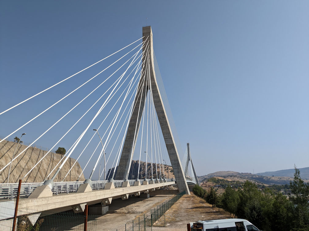
 (L) Nissibi Euphrates Bridge across the Euphrates
(R) A huge reservoir is created by the Ataturk Dam for irrigation
(L) Nissibi Euphrates Bridge across the Euphrates
(R) A huge reservoir is created by the Ataturk Dam for irrigation

 (L) Soldiers guided Nissibi Bridge. They were happy to chat with us via our guide for translation.
According to Hassan, these soldiers were recruited from Kurdish villages. It is one way that the Turkish government
does to pacify the Kurdish population. Minimal training was provided to these soldiers.
(L) Soldiers guided Nissibi Bridge. They were happy to chat with us via our guide for translation.
According to Hassan, these soldiers were recruited from Kurdish villages. It is one way that the Turkish government
does to pacify the Kurdish population. Minimal training was provided to these soldiers.
(R) Armored vehicle guiding the bridge

 (L) Mount Nemrut, a mountain with limestone statues of Greek and Iranian gods set around an ancient royal tomb.
(R) Hills surrounding Mount Nemrut which is at a 7000 ft elevation.

 (L) Eastern Terrace statues (R) Western Terrace statues

 (L) Heads of statues were taken down from their pedestals (see also previous photos) to prevent further earthquake damages
(R) Sunset over Mount Nemrut

 Damaged buildings in Adiyaman from 6 February 2023 earthquake in Turkiye centered
20 miles west of Gaziantep
Damaged buildings in Adiyaman from 6 February 2023 earthquake in Turkiye centered
20 miles west of Gaziantep
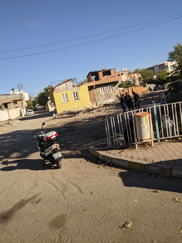
 Earthquake damaged buildings in Adiyaman

 Ataturk Dam (L) on the Euphrates built for irrigating the arid region (R)
Gobeklitepe
Gobeklitepe is a Neolithic archaeological site in southern Turkiye - 5 miles east of Şanlıurfa
(100 miles east of Gaziantep). The settlement was inhabited from around 9500 BCE to 8000 BCE.
It is famous for its large circular structures that contain, among the world's oldest, stone pillars (megaliths).
Findings in the site provide insights into prehistoric religion of the period.
The site played a prominent role in the debate of whether farming caused people to settle down or vice versa.
A detailed description of the site and the debate can be found on the
Wikipedia page.
 (L) Panoramic view of the Gobeklitepe ruins
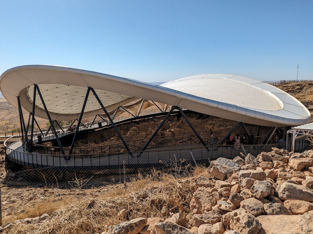
 (L) Gobeklitepe site under the cover of a protective structure
(R) Neolithic megaliths
(L) Gobeklitepe site under the cover of a protective structure
(R) Neolithic megaliths

 Animals carved on Gobeklitepe megaliths
Karahantepe
Karahantepe is another Neolithic archaeilogical site about 30 miles east of Sanliurfa.
It is believed to be related to Gobeklitepe.
The site may be the earliest known human village, predating the construction of Gobekli Tepe,
dating to between 9500 and 10,000 BCE.

 Human head (L) and animal carvings (R) in Karahantepe

 Karahantepe
Sanliurfa

 (L) Mevlid-i-Halil cave in Sanliurfa, presumably the birth place of Abraham
(R) Rizvaniye Mosque, a mid-eighteenth century CE Ottoman mosque and school in the city of Sanliurfa.

 (L) Interior of Rizvaniye Mosque
(R) Ayn-i-Zeliha Lake - According to local folklore, the lake formed from the tears of Zeliha,
the daughter of Nimrod, when she witnessed the miraculous escape of Prophet Ibrahim
from the fiery furnace.
Gaziantep

 (L) Workmen stabalizing the earthquake damaged hillside below the Gaziantep City wall
(R) We stayed in a modernized caravanserai-like hotel in Gaziantep

 The Zeugma Mosaic Museum in Gaziantep has the amazing collection of mosaics
recovered from old mansions
The Zeugma Mosaic Museum in Gaziantep has the amazing collection of mosaics
recovered from old mansions
(L) On the floor (R) Hanging from walls
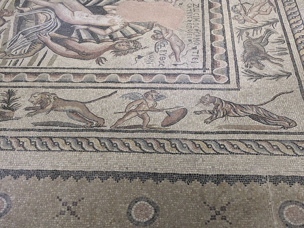
 (L) Animal mosaic (R) Simple geometric mosaic

 (L) Soldiers at check points usually found at the edges of towns in eastern Turkiye
(R) Tea seller in Gaziantep carrying tea on his back
We flew from Gaziantep to Istanbul and then home from there.
Turkish Airlines has a convenient network of routes to the Middle East and Central Asia
using Istanbul as a hub. This ends our month-long adventure in Turkiye.
Turkiye Home Page
Eastern Turkiye Part 1: Trabzon to Mount Ararat
Western Turkiye Part 1: Istanbul to Konya
Western Turkiye Part 2: Antalya to Ephesus
Back to Home Page
Leave Comments
|